
Checked out of our cabin at Convict Lake around 7:30am and picked up some supplies at Convict Lake store before heading north to Bridgeport.

First cow sighting for our pooches off Convict Lake Road just before junction with Hwy. 395. While Addy was just mildly curious, Sasha went temporarily ape shit, rendering us temporarily deafwith her ear-splitting barking. As for the cow? She really couldn't care less...moooooooo!

Mono Lake off Hwy. 395 just north of Lee Vining.

Aftermath of the Marina Fire above the west shore of Mono Lake.
We had no idea there had been a fire here last month until we came across this visage while driving past and I looked it up online. This 650+ acre human-caused fire started on 6/24 and was contained by 6/30.
We had no idea there had been a fire here last month until we came across this visage while driving past and I looked it up online. This 650+ acre human-caused fire started on 6/24 and was contained by 6/30.
Hwy. 395 between Lee Vining and Lundy Lake Road.

Burn area of the Marina Fire on the other side of Hwy. 395

By 8:40am we arrived at State Rte. 270 (aka Bodie Road), the turnoff to Bodie State Historic Park.

Our first stop along Bodie Road was a pullout descending to a wet meadow below.
I was hoping to see lots of blooms as we had in prior years but was, once again, disappointed. A pox on you, you fraudulent El Nino!!!! But, alas, all was not lost when I spotted this very handsome Mountain Bluebird perched on an errant log in a sea of meadow grasses, just daring me to take its photo, which I promptly did or tried to, after shushing and hissing under my breath at Gil, Addy & Sasha to STOP WALKING!!! Of course, all three just stared balefully and blankly at me like, I wonder what she's got her panties all in a twist about, and kept moseying on ahead. With the 3 stooges (aka, Laurel, Hardy and Hardiette) not heeding my entreaties, (they seldom do) I frantically took about 20 frenetic shots in 5 seconds flat before the dang thing predictably flew away. But, hey, at least I managed to get one decent photo.
I was hoping to see lots of blooms as we had in prior years but was, once again, disappointed. A pox on you, you fraudulent El Nino!!!! But, alas, all was not lost when I spotted this very handsome Mountain Bluebird perched on an errant log in a sea of meadow grasses, just daring me to take its photo, which I promptly did or tried to, after shushing and hissing under my breath at Gil, Addy & Sasha to STOP WALKING!!! Of course, all three just stared balefully and blankly at me like, I wonder what she's got her panties all in a twist about, and kept moseying on ahead. With the 3 stooges (aka, Laurel, Hardy and Hardiette) not heeding my entreaties, (they seldom do) I frantically took about 20 frenetic shots in 5 seconds flat before the dang thing predictably flew away. But, hey, at least I managed to get one decent photo.

Meadow off Bodie Road.

A driveable dirt track from the meadow leads up to a wide clearing where a couple trailers were parked. We heard dogs barking in the trailers and presumed that they must belong to the sheep herder(s) tending a large flock of sheep visible in the distance. We were initially alerted to the presence of the sheep by a large white dog guarding them about a half mile up the road, who first spotted and started barking furiously at us and our two city slicker pooches waaaaaaay before we spotted him (go figure).

Meadow off Bodie Road.

Captain, there be sheep here!

Wow! We'd never seen sheep off of Bodie Road before. How cool is that?

Kind of cut off in this shot, but there were 2 or 3 sheepdogs, maybe a Great Pyrenees and a couple of Aussies? taking a power nap under that tree to the left. Shift rotation...it ain't just for humans anymore.

End of SR 270, before it becomes a graded dirt road leading to the park entrance. Since we've visited the ghost town before, it was not on our agenda for this trip so we turned around and headed back to 395.

Descending Bodie Road.

Bodie Road at 8,000 ft.

On our way back down, some of the sheep had meandered up onto the road itself.

This was the guy (looks like a Great Pyrenees) who had been barking at us earlier. Smart, handsome, athletic, and protective. What a keeper! Too bad I didn't get a shot of the human Basque sheepherder cuz he's probably a keeper, too, heh heh...

Continuing down Bodie Road.

Nearing the junction with Hwy. 395

Marker near junction between Bodie Road and Hwy. 395
It reads:
Poor Farm
It began as the county hospital in Bodie in 1879. With the decline of Bodie in the mid 1880's the hospital was eventually moved to a site east of this monument and Highway 395 to the rear of the small meadow that you see. At that time it became known as the "Poor Farm," a refuge for the aged, ill and penniless. It continued to operate for several years, but the high cost of maintaining the facility forced its closure and the buildings and property were put up for sale and sold to a local rancher.
Dedicated September 8, 1990, Bodie Chapter No. 64, E Clampus Vitus

Green Creek Road at turnoff from Hwy. 395

Green Creek Road

Zerene Fritillary (Speyeria zerene)
Dunderberg Meadow Road, where we made an accidental left instead of right turn at T intersection of Green Creek Rd.

Dunderberg Meadow Road

Mountain Monardella (Monardella odoratsissima)
Dunderberg Meadow Road
Dunderberg Meadow Road

Douglas' Campion (Silene douglasii)
Dunderburg Meadow Road
Dunderburg Meadow Road

Driving back up Dunderberg Meadow Road to T intersection of Green Creek Road (should have turned right earlier to continue to Green Creek Camp)

Here we are, back on track at the T intersection of Green Creek Road, aka Forest Service Rd. 142 (note that sometimes the first two digits of an FSR is omitted, but here on the actual sign it's "32142")

Turning right onto Green Creek Road

Dynamo Pond was originally built in the 1890s to provide hydroelectric power to Bodie. It has undergone habitat restoration and is managed by California Dept. of Fish & Wildlife https://www.wildlife.ca.gov/Lands/Places-to-Visit/Green-Creek-WA

Marker for Dynamo Pond

Green Creek Road

Entering Toyaibe NF on Green Creek Road (Hellooooooo!)

Green Creek Road
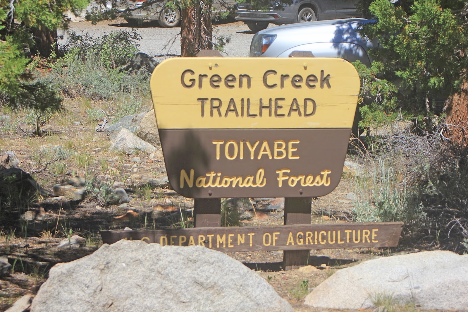
Green Creek Trailhead at the roadend

Green Creek Trailhead

After turning back from Green Creek Trailhead, we stopped off at a nice, shady campsite right next to the creek for lunch. Can't tell you the site number because, well, the sites aren't numbered. Btw, the skeeters were out in force so we had to slather on the Off! Deep Woods Insect Repellant. As for our fur babies, they take a monthly dose of Sentinel so are protected from heart worm and are also master Ninja insect catchers (or at least Sasha is). Be prepared because mosquitoes are always prolifically pesky during the late spring-early summer months, especially anywhere near a water source here in the Eastern Sierra.

Green Creek next to the campsite

Hoary Comma (Polygonia gracilis)
Campsite on the bank next to Green Creek
Campsite on the bank next to Green Creek

Hoary Comma (Polygonia gracilis)
Campsite on the bank next to Green Creek
Campsite on the bank next to Green Creek

Possibly a Boisduval's Blue (Plebejus icarioides)
Campsite on the bank next to Green Creek

Lupine species at campsite next to Green Creek

Ranger's Buttons (Sphenosciadium capitellatum)
Campsite next to Green Creek
Campsite next to Green Creek

Coulter's Daisy (Erigeron coulteri)
Campsite next to Green Creek
Campsite next to Green Creek

Bog Mallow (Sidalcea oreganum)
Campsite next to Green Creek
Campsite next to Green Creek

Slender Cinquefoil (Potentilla gracilis)
Campsite next to Green Creek
Campsite next to Green Creek

Gil, desperately seeking GPS signal. Bwahahahaha! laughs mother nature.

Green Creek next to the campsite

Leichtlin's Mariposa Lily (Calochortus leichtlinii)
Green Creek Road before campsites
Green Creek Road before campsites

Mule Ears (Wyethia mollis)
Green Creek Road before campsites
Green Creek Road before campsites

Leichtlin's Mariposa Lily (Calochortus leichtlinii)
Green Creek Road before campsites
Green Creek Road before campsites

Penstemon species
Green Creek Road before campsites
Green Creek Road before campsites

There are a number of pullouts and primitive (DFG) campsites off of Green Creek Road. This one is right next to a beautiful expanse of Green Creek. Again, be prepared for skeeters this time of year.

Hand-crafted fire ring at this primitive but very lovely campsite.

Common Horsetail (Equisetum arvense) in the understory of pine trees along Green Creek at the primitive campsite.

Common Horsetail (Equisetum ravens)
Along Green Creek at the primitive campsite.
Along Green Creek at the primitive campsite.

Green Creek Road

Leaving Toiyabe NF on Green Creek Road (Arrivederci!!!)

Campers off Green Creek Road

Heading back to Hwy. 395 on Green Creek Road

Prickly Poppy (Argemone munita), descending Green Creek Road

Wood's Rose (Rosa woodsii), descending Green Creek Road

Green Creek

Bridge crossing over Green Creek, about 1.2 miles from the campsites

Descending Green Creek Road towards Hwy. 395. Is that Bridgeport Reservoir in the backdrop?

Twin Lakes Road

Twin Lakes Road

Twin Lakes Road

Twin Lakes Road

Twin Lakes Road

An amiable-looking bull or steer (castrated or not castrated...that is the question) off Twin Lakes Road

Beautiful field of flowers off Twin Lakes Road in Bridgeport

Twin Lakes Road

Twin Lakes Road

Twin Lakes Road

Twin Lakes Road

Twin Lakes Road

Ascending Twin Lakes Road

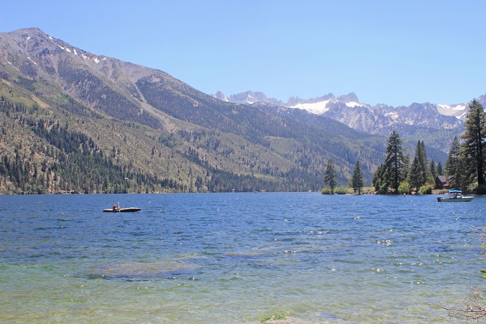
Twin Lakes General Store at Lower Twin Lakes

Lower Twin Lakes

Cabins/homes at Lower Twin Lakes

Lower Twin Lakes

Lower Twin Lakes

Lower Twin Lakes

Lower Twin Lakes

Dock at Lower Twin Lakes

Finally, a nice, accessible, sandy & clear spot just past the dock at Lower Twin Lakes

Pups are running to the water like moths to a flame

Lower Twin Lakes
Lower Twin Lakes

Damn, that's some good agua!

Synchronized drinking, the next Olympic sport

Sasha found a dead fish along the shore and, before I could stop her, grabbed it up in her mouth. When I yelled at her to SPIT IT OUT!!! she gave me her infamous, signature stare-glare: GO AHEAD MOMMY - MAKE ME!!! MAKE MY DAY!!! Which I promptly did cuz, frankly, she's no match for her momma. That applies to you, too, Gilbo.

Lower Twin Lakes

Saw a deer as we headed up South Twin Road, which parallels the opposite shore of Twin Lakes

South Twin Road is graded dirt, but narrow and bumpy in areas. A number of cabins here, but probably not accessible in the winter.

South Twin Road

On our way back down from South Twin Road, we pulled over to Crags Campground, about a mile from the Lower Twin Lakes General Store, to check it out. Although situated in mostly exposed rocky sagebrush scrub habitat, the sites are well-spaced and RV-friendly, with a number of them partially shaded by trees. A great alternative to the campground that's actually next to Robinson Creek, which is perpetually crowded and also a pesky mosquito magnet during the more popular summer months.


Crags Campground

Deer taking a siesta at one of the campsites

We've earmarked this site as a good one.

Site #14
No comments:
Post a Comment