It's been many moons since our last trip to Death Valley. Back in our younger "desert rat days" we'd tent-camped at various locations throughout the park, including Furnace Creek, Wildrose, and Mesquite Spring, braving wind, heat, and cold depending on the season. Now that we're a bit older and we have the RV, the prospect of camping is much less formidable and certainly much easier on the joints. With a wetter than expected winter season this year, the wildflower show at the park was reported to be pretty good, although waning a bit in the lower elevations by the time we came through here in early April.
I had reserved a site for us at Furnace Creek campground a couple months earlier and it was a good thing I did because the campground was full by the time we arrived. Ours was not a full hook-up site, but at least it was under the shade of tamarisk trees.
We left Starbucks at Oak Creek Center in Wildomar at 10:07am on Sunday morning after picking up our requisite caffeinated drinks and breakfast sandwiches before heading up I-15 north on our way to DVNP. It was, at the time, a very mildly pleasant 71F.
By 1pm, we finally arrived at Baker, where the temperature was a bit balmier at 89F.
2pm and 241 miles later from our starting point at Wildomar/Murrieta, we stopped at the Chevron gas station in Shoshone to fill up on diesel.
At 4pm, we finally arrived at the Furnace Creek visitor center where it was just a tad under 100F. Yup, that's Death Valley in April for ya...
After stopping briefly at the visitor center, we headed up to Furnace Creek campground, which is about a mile north of the visitor center on CA 190 to the left.
TRIP NOTES: The Furnace Creek visitor center opens at 8:00am; gas (including diesel), and a general store with groceries and other amenities are available at nearby Furnace Creek Ranch. Toilets, water and some full hook-up RV sites available at the campground.


I had reserved a site for us at Furnace Creek campground a couple months earlier and it was a good thing I did because the campground was full by the time we arrived. Ours was not a full hook-up site, but at least it was under the shade of tamarisk trees.
Sunday April 2, 2017:
By 1pm, we finally arrived at Baker, where the temperature was a bit balmier at 89F.
2pm and 241 miles later from our starting point at Wildomar/Murrieta, we stopped at the Chevron gas station in Shoshone to fill up on diesel.
At 4pm, we finally arrived at the Furnace Creek visitor center where it was just a tad under 100F. Yup, that's Death Valley in April for ya...
After stopping briefly at the visitor center, we headed up to Furnace Creek campground, which is about a mile north of the visitor center on CA 190 to the left.
TRIP NOTES: The Furnace Creek visitor center opens at 8:00am; gas (including diesel), and a general store with groceries and other amenities are available at nearby Furnace Creek Ranch. Toilets, water and some full hook-up RV sites available at the campground.

I-15N at Kelbaker Rd/CA127 junction

CA 127N between Baker and Shoshone

CA 127N between Baker and Shoshone

CA 127N between Baker and Shoshone

Shoshone

CA 127 between Shoshone and Death Valley Junction

CA 127 between Shoshone and Death Valley Junction

Death Valley Junction (CA 127 & CA 190)

Death Valley Junction

Garage at Death Valley Junction
I love old abandoned buildings!
I love old abandoned buildings!

Amargosa Opera House, Death Valley Junction
We drove by the Opera house on our way through Death Valley Junction and saw a line of bikers parked by the building, perhaps to pay their respects to Marta Beckett who passed away at age 92 on January 30, 2017. Marta, a dancer, choreographer, writer and artist, originally from New York City, had occupied the opera house since 1968 where she performed her one-woman show. There's an Emmy Award-winning documentary from 2000 about her called Amargosa that's available to watch on Amazon video. I had always hoped to catch one of her shows whenever we came through here but never had the opportunity. RIP Marta!

Amargosa Opera House, Death Valley Junction

Turning onto CA 190 from Death Valley Junction

CA 190N

Entering fee area for Death Valley National Park

DVNP along CA 190N between Death Valley Junction and Furnace Creek

DVNP along CA 190N between Death Valley Junction and Furnace Creek

DVNP entry monument off CA 190N between Death Valley Junction and Furnace Creek

DVNP, CA 190N between Death Valley Junction and Furnace Creek

DVNP, CA 190N between Death Valley Junction and Furnace Creek

DVNP, CA 190N between Death Valley Junction and Furnace Creek

DVNP, CA 190N between Death Valley Junction and Furnace Creek

DVNP, CA 190N between Death Valley Junction and Furnace Creek

DVNP, CA 190N between Death Valley Junction and Furnace Creek

DVNP, CA 190N between Death Valley Junction and Furnace Creek

DVNP, CA 190N between Death Valley Junction and Furnace Creek

DVNP, CA 190N between Death Valley Junction and Furnace Creek

20 Mule Team Canyon, DVNP, CA 190N between Death Valley Junction and Furnace Creek

20 Mule Team Canyon, DVNP, CA 190N between Death Valley Junction and Furnace Creek

20 Mule Team Canyon, DVNP, CA 190N between Death Valley Junction and Furnace Creek

Zabriskie Point, DVNP, CA 190N between Death Valley Junction and Furnace Creek

A line of teensy weensy people at the top of the ridge at Zabriskie Point
 Zabriskie Point
 CA 190N between Zabriskie Point and Furnace Creek
 CA 190N between Zabriskie Point and Furnace Creek
 CA 190N between Zabriskie Point and Furnace Creek
 CA 190N between Zabriskie Point and Furnace Creek
 Furnace Creek Inn
 Furnace Creek Inn

 Furnace Creek Inn
 Furnace Creek
 Furnace Creek
 Furnace Creek Ranch
 Furnace Creek Ranch
 Furnace Creek Visitor Center
 Furnace Creek Visitor Center


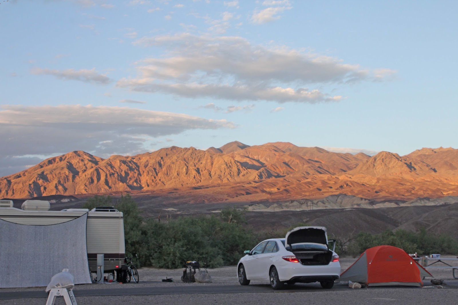
 Furnace Creek Campground
 Our site #44 at Furnace Creek Campground.


Addy trying to decide between beer or champagne
 But Dad's sandwich looks mo betta!


 Site #44 at Furnace Creek Campground
 Great-tailed Grackle (Quiscalus mexicanus) on Tamarisk tree at our campsite #44
 Eurasian Collared Dove (Streptopelia decaocto), on Tamarisk tree at our campsite #44

 Campsite #45
 Behind Campsite #45

Behind Campsite #45
 Behind Campsite #45
 Behind Campsite #45
 Behind Campsite #45
 Behind Campsite #45

Behind Campsite #45
 Behind Campsite #45
 Behind Campsite #45
 Behind Campsite #45
 Gil starting the fire for dinner
 Addy waiting on top of the table for dinner.
 Grilled sweet peppers, zucchini, and portabello mushrooms
 Someone left a large pile of wood planks at our campsite-very convenient!

 Leaving Furnace Creek on Monday morning on CA 190N to Olancha en route to Red Rock Canyon State Park.
 Mesquite Flat Dunes before Beatty Junction.
From https://www.nps.gov/deva/learn/nature/sand-dunes.htm
 Scotty's Castle is closed until 2019 due to extensive damage from the flash floods of 2015
https://www.nps.gov/deva/learn/nature/flood-2015.htm

 Devil's Cornfield
 Devil's Cornfield
 Arrowweed (Pluchea sericea), Devil's Cornfield
 Arrowweed (Pluchea sericea), Devil's Cornfield

Iondinebush / Pickleweed (Allenrolfea occidentalis),
a super salt-tolerant shrub with fleshy green stems, Devil's Cornfield
 Devil's Cornfield
 Devil's Cornfield
 Stovepipe Wells
 Stovepipe Wells
 Stovepipe Wells

 White Bursage (Ambrosia dumosa)
Day use area between Stovepipe Wells and Emigrant
 Creosote Bush (Larrea tridentata)
Day use area between Stovepipe Wells and Emigrant
 Notch-leaved Phacelia (Phacelia crenulata)
Day use area between Stovepipe Wells and Emigrant
 Yellow Cups (Chylismia brevipes)
Day use area between Stovepipe Wells and Emigrant
 Desert Chicory (Rafinesquia neomexicana)
Day use area between Stovepipe Wells and Emigrant
 Day use area between Stovepipe Wells and Emigrant
 Cryptantha species
Day use area between Stovepipe Wells and Emigrant
 Day use area between Stovepipe Wells and Emigrant
 Parking lot of day use area between Stovepipe Wells and Emigrant
 Gravel Ghost (Atrichoseris platyphylla)
Day use area between Stovepipe Wells and Emigrant
 Pebble Pincushion (Chaenactis carphoclinia)
Day use area between Stovepipe Wells and Emigrant
 Day use area between Stovepipe wells and Emigrant
 CA 190W at intersection with Emigrant Canyon Rd (to Wildrose Road)
 CA 190W between Emigrant and Towne Pass
 CA 190W between Emigrant and Towne Pass
 Cheesebush/Burrobrush (Ambrosia salsola)
CA 190W between Emigrant and Towne Pass
 Indigo Bush (Psorothamnus arborescens)
CA 190W between Emigrant and Towne Pass
 Desert Trumpet (Eriogonum inflatum)
CA 190W between Emigrant and Towne Pass
 Rattlesnake Weed/Whitemargin Sandmat (Euphorbia albomarginata)
CA 190W between Emigrant and Towne Pass
 Mojave Aster (Xylorhiza tortifolia)
CA 190W between Emigrant and Towne Pass
 Death Valley Phacelia (Phacelia vallis-mortae)
CA 190W between Emigrant and Towne Pass
 Spiny Hopsage (Grayia spinosa)
CA 190W between Emigrant and Towne Pass
 Towne Pass, CA 190W
 Towne Pass
 Towne Pass
 Descending CA 190W from Towne Pass to Panamint Valley
 CA 190W heading towards Panamint Valley
 CA 190W heading towards Panamint Valley
 CA 190W heading towards Panamint Valley (Panamint Valley visible in the distance)
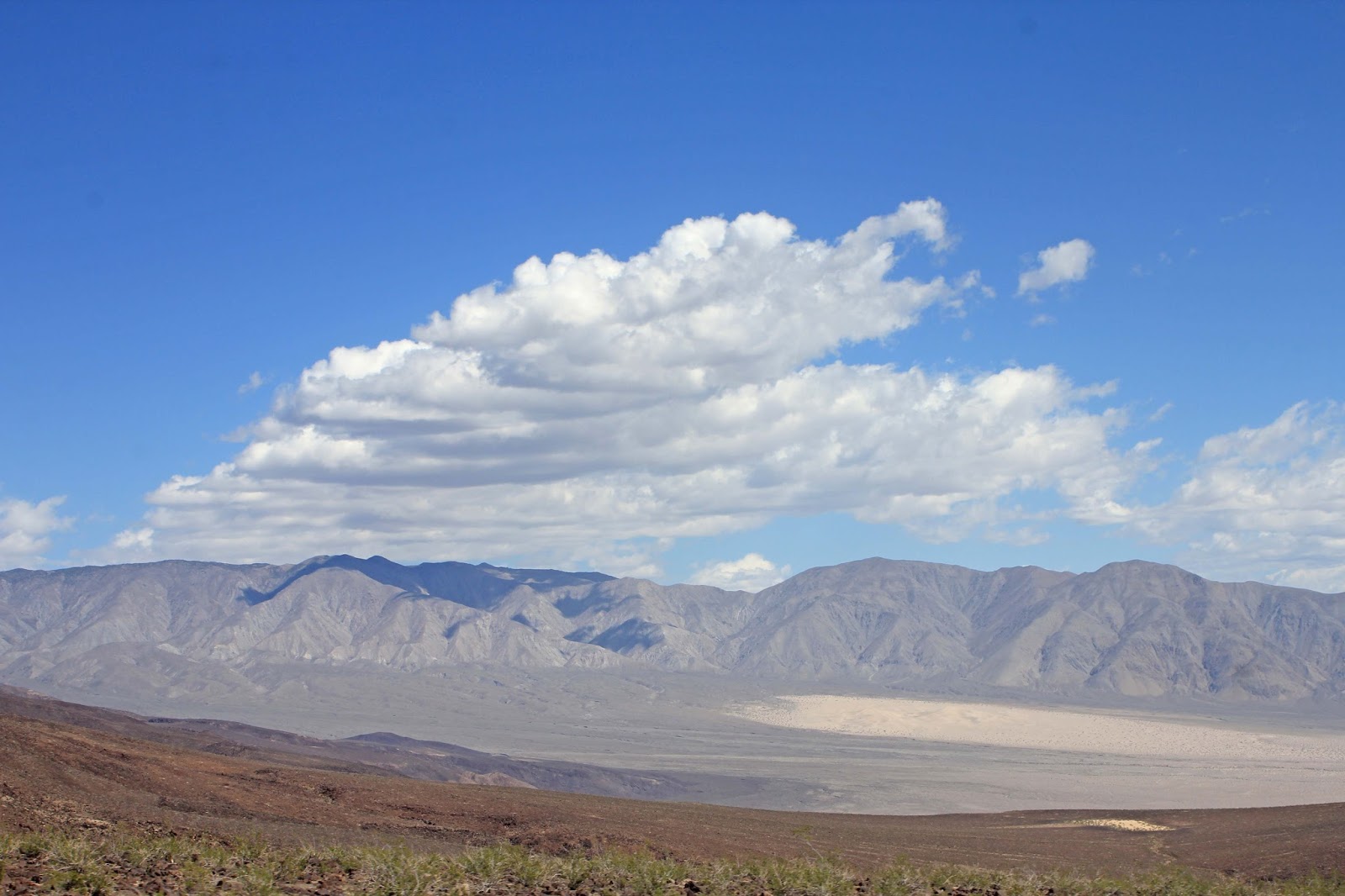
 Panamint Valley
 Panamint Valley
 Junction of CA 190 and Panamint Valley Road (to Trona)
 Panamint Springs
 Panamint Springs
 Leaving Panamint Springs on CA 190W to Father Crowley Point
 CA 190W between Panamint Springs and Father Crowley Point
 CA 190W between Panamint Springs and Father Crowley Point
 CA 190W between Panamint Springs and Father Crowley Point
 CA 190W between Panamint Springs and Father Crowley Point
 CA 190W between Panamint Springs and Father Crowley Point
 CA 190W between Panamint Springs and Father Crowley Point
 CA 190W between Panamint Springs and Father Crowley Point
 Rainbow Canyon at Father Crowley Point
 Father Crowley Point
 Continuing west on CA 190 from Crowley Point to Junction with CA 136
 Leaving the boundary of Death Valley National Park
 CA 190W to junction of CA 136
 CA 190W with view of snow-capped Sierra Nevadas
 CA 190W
 CA190W
 CA 190W
 CA190W
 CA 190W
 CA 190W
 CA 190W
 CA 190W with view of Owens Lake
 CA 190W with view of Owens Lake
 Owens Lake.
 CA 190W with view of Owens Lake
 CA 190W with view of Owens Lake
 CA 190W with view of Owens Lake
 CA 190W with view of Owens Lake
 CA 190W at junction with CA 136 (to Lone Pine)
 CA 190W at junction with CA 136
 CA 190W at junction with CA 136
 CA 190W at junction with CA 136
 CA 190W at junction with CA 136
 CA 190W at junction with CA 136
 CA 190W at junction with CA 136
 CA 190W at junction with CA 136
 CA 190W at junction with CA 136

CA 190W at junction with CA 136
 CA 190W at junction with CA 136
 CA 190W at junction with CA 136
 CA 190W at junction with CA 136
 CA 190W heading to Olancha, with dust from Owens Lake visible (a very windy day today)

CA 190W heading to Olancha
 CA 190W heading to Olancha, more dust visible
 Dust really kicking up here
 CA 190 at junction with Hwy. 395 at Olancha
 Gus's Fresh Jerky in Olancha off Hwy. 395
And in case you're wondering, yes, their jerky is really good
 Gus's Fresh Jerky
From this point on, heading towards Hwy. 14 to Red Rock Canyon State Park in Kern County


Ok, I know "4" is an unlucky number for us Chinese, but 4+4=8 a lucky number, no?
Embarrassingly, but predictably, Addy took a ginormous horse dump right next to our neighbor's rig. Sure had fun cleaning that up, Addy poo! :(
Embarrassingly, but predictably, Addy took a ginormous horse dump right next to our neighbor's rig. Sure had fun cleaning that up, Addy poo! :(


Addy trying to decide between beer or champagne


Behind Campsite #45


Behind Campsite #45


Monday April 3, 2017:
The next morning, we stopped by the Visitor Center at Furnace Creek where I picked up some books and also a couple souvenir pins. Lots of tourists, btw, mostly day trippers. By 9:30am, the temperature was creeping up into the 80s. Our plan today was to drive west on CA 190 to Olancha, turn south on Hwy. 395, then onto CA 14S to Red Rock Canyon in Kern County where we would camp overnight at Ricardo Campground.


From https://www.nps.gov/deva/learn/nature/sand-dunes.htm
"These dunes are the best known and easiest to visit in the national park. Located in central Death Valley near Stovepipe Wells, access is from Hwy. 190 or from the unpaved Sand Dunes Road. Although the highest dune rises only about 100 feet, the dunes actually cover a vast area. This dune field includes three types of dunes: crescent, linear, and star shaped. Polygon-cracked clay of an ancient lakebed forms the floor. Mesquite trees have created large hummocks that provide stable habitats for wildlife."

https://www.nps.gov/deva/learn/nature/flood-2015.htm

About 2.5 miles from Scotty's Castle Road along CA 190 is Devil's Cornfield. The shrubs that grow across this flat, sandy landscape are Arrowweed (Pluchea sericea), which resemble cornstalks but are actually in the sunflower family (Asteraceae).


Iondinebush / Pickleweed (Allenrolfea occidentalis),
a super salt-tolerant shrub with fleshy green stems, Devil's Cornfield


Lesser Goldfinches on a Creosote Bush at the day use area between
Stovepipe Wells and Emigrant. There's a paved parking area here along with pit toilets and trash bins. We saw some RVs & tents a short distance up to the right, so there's probably dispersed camping allowed nearby.

Day use area between Stovepipe Wells and Emigrant

Day use area between Stovepipe Wells and Emigrant

Day use area between Stovepipe Wells and Emigrant

Day use area between Stovepipe Wells and Emigrant

Day use area between Stovepipe Wells and Emigrant


Day use area between Stovepipe Wells and Emigrant


CA 190W between Emigrant and Towne Pass

CA 190W between Emigrant and Towne Pass


CA 190W between Emigrant and Towne Pass


CA 190W between Emigrant and Towne Pass


When we arrived at the vista point, we saw four F-18 fighter jets roar through the canyon in quick succession. VERY loud and very cool! In fact, this was Gil's highlight of the trip (you should have seen that Cheshire cat grin on his face!). We didn't know they were coming so didn't have a chance to video them on our iPhones (although another more-informed visitor did). Upon further research after our trip, we found out that the gorge, nicknamed "Star Wars Canyon," is where U.S military pilots have regularly trained since WWII.


Snowmelt from the Eastern Sierra snowpack, which is 241% above normal due to a very wet winter season this year, could flood the normally dryish Owens Lake bed as the weather warms up
http://www.scpr.org/news/2017/03/20/70045/melting-record-snowpack-could-flood-la-aqueduct-an/


CA 190W at junction with CA 136


CA 190W heading to Olancha


And in case you're wondering, yes, their jerky is really good

From this point on, heading towards Hwy. 14 to Red Rock Canyon State Park in Kern County
No comments:
Post a Comment